In the quest for greater insights that drive business outcomes, organizations in a variety of industries have been active in harnessing data in new and innovative ways. A good portion of this activity involves doing more with what is immediately available—the data that a business holds and operationalizes day to day.
As the global economy evolves, however (alongside critical events that affect world economies—from war to the effects of climate change), a more proactive approach to uncovering economic and environmental insights must be taken. If we assume businesses are already using all the data that is typical for their industry, it is only natural that alternative-data sources hold the key to uncovering these insights.
Alternative data—nontraditional data—is often used by investors to assess the performance of financial assets. Increasingly, advanced tools and technologies that can harness both traditional and alternative data effectively (such as artificial intelligence (AI), machine learning (ML), deep learning, and natural-language processing) are accelerating innovation in every realm. When applied to alternative data from satellites, computer vision—software trained to derive information and insight from visual inputs—presents a particularly clear and compelling example of how these technologies are accelerating innovation and data insights.
The Sky's Not the Limit
With more and more satellites being launched every year, the potential of computer vision when applied to Earth observation data is growing significantly. We are now in a better position than ever to track human activity and its effect on the environment from orbit; likewise for the effect the environment (such as weather and natural disasters) can have on societies and economies.
In many respects, economies and the environment are closely linked—particularly in parts of the world where agriculture is a significant part of a country's economic output. With increased scrutiny around sustainability practices and the environmental impact of organizations, stakeholders across all industries are beginning to demand more robust ESG reporting and data to safeguard investments. To these ends, computer-vision models trained on satellite data are delivering incredible value.
Understanding Satellite Data
To understand the insights that can be derived from satellite data, it is important to understand the different types of data we can get from satellites and how they are useful for tracking macroeconomic insights.
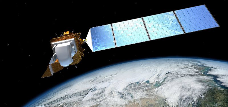
The first category of satellite is that of Earth-observation satellites, such as Sentinel-2 and Landsat 8, as well as high-resolution satellites, such as the Pléiades constellation of satellites. As the name suggests, these satellites provide optical imagery that allow us to clearly measure topographical information relating to the built and natural environments—even to a resolution of 50cm.
Such imagery can then be processed by computer-vision models to derive insights on urban growth by detecting the new built-up areas by city or regions. The physical features observed at a resolution of 50cm with Pléiades are extremely valuable when it comes to classifying and categorizing sites related to mining, agriculture, manufacturing, and oil and gas. Observation of these distinct features can provide additional layers and contribute to capturing sector-specific insights.
Atmospheric satellites, such as Sentinel-5P and OCO-2, allow us to go a step further. With atmospheric satellites, we can track the level of pollutants in the atmosphere (such as NO2, SO2, and methane) emitted from a given asset (for instance, a power station). We can also track the presence of these gases at a regional and national level.
This information can be used to estimate the level of industrial production by region. As such, these insights are becoming increasingly important to creating real-time macroeconomic indicators specifically to monitor economic recovery and growth. For instance, an increase in the presence of these gases could indicate a higher GDP ahead of official data.
In addition, these insights could be used to refocus ESG efforts—particularly at an asset level—because they can be used to provide a clearer view of environmental impact.
Radar satellites, such as Sentinel-1, allow us to continue observation even when weather conditions disrupt optical satellites, as radar bypasses cloud cover. Similarly, thermal images provided by Earth-observation satellites such as Landsat 8 and Sentinel 3 give us information on the temperature at ground-level; these images provide a more detailed picture of industrial activity when combined with other satellite data.
Using the information from satellites we can develop indicators relating to urban growth, air pollution, and even water stress to provide macroeconomic and environmental insights. For example, high air pollution and urban growth indicate high economic output. Water stress, meanwhile, can indicate potential challenges when it comes to agricultural production such as would have an adverse economic effect.
The Importance of Robust Model Construction
To ensure reliable computer-vision insights from satellite data, it is essential that the methodology to construct the models is robust. Let's consider satellite-data integration with macroeconomic indicators.
When the model's goal is to obtain new insights into industrial activity and its impact on economic growth, we may train the model to observe industrial and construction activity using satellite data. This requires that we verify the type of features that indicate increased industrial and construction activity. For example, the presence of construction sites relating to residential buildings and commercial premises may indicate increased investment and economic activity—which may affect regional economic output and GDP.
We also need to incorporate other key information, however—such as insights from other alternative-data sources—using techniques such as natural-language processing. For example, information from local news stories and social-media conversations can be used to validate the context of construction sites. Through further enrichment steps, it is also possible to create models that provide more detailed analysis at a sectoral level—such as determining whether a site is related to mining, agriculture, manufacturing, or oil and gas.
Application of Satellite Data for ESG Investment
Once robust models are created to process satellite data with computer-vision technology, they can be applied globally to obtain insights for different purposes.
One use case is that of closing the data gaps that exist in ESG rating and reporting. Today, investors require more granular insights to identify the assets in their portfolios that are exposed to the most risk. If satellite data is processed accurately and mapped to the granular asset level, such information can be used to cross-check the self-declared ESG ratings published by companies.
Consider, for example, a mining company with dozens of assets around the world. We can use computer-vision algorithms trained on satellite images to track deforestation across all the mines and air pollution from all smelters. We can then create a time-series database to provide real-time ESG information, which can be aggregated at the company level.
Satellite computer-vision models are also particularly useful when it comes to countries and organizations that are less than forthcoming with economic and environmental information—because the insights from satellite data can be used to show the real picture. For more comparative analysis, APIs can be used to obtain historical satellite data that reveals the rate of growth or decline over time. This can then be used to develop compelling data visualizations for investors, organizations, governments, and economists.
Increasingly, it is through such methods that the true stories of the planet's ecosystems and economies are being told. This is why I expect more of us will be looking beyond the sky to find answers to our most pressing questions.
Keep learning
Get up to speed fast with TechBeacon's guide to the modern data warehouse.
Download the Buyer's Guide to Data Warehousing in the Cloud.
Get up to speed on digital transformation with TechBeacon's Guide.
How important is digital transformation to your org? Take our survey and find out how you stand next to the competition.
Thinking of making a change? TechBeacon's Careers Topic Center provides expert advice to prepare you your next career move.
